Historic Photo: Dubai Creek in 1964, compared to today.
The mainstay of this waterway used to be pearls. Now it's oil, and high finance.
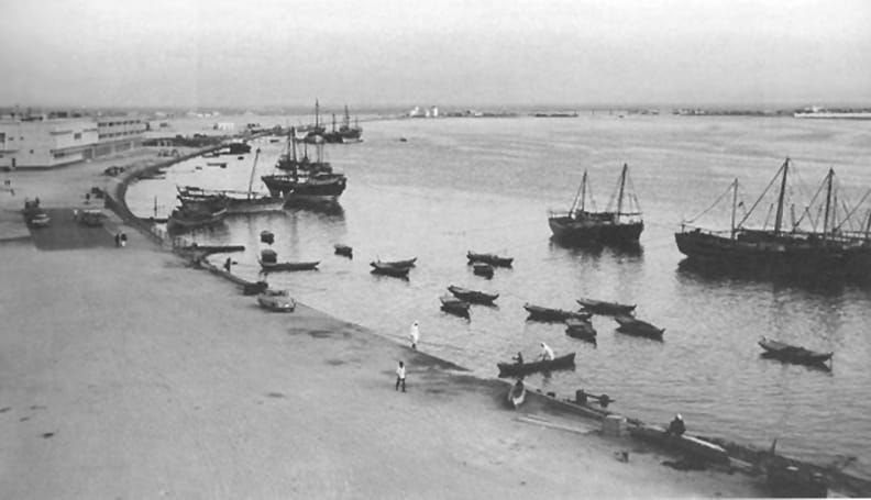
This photo was taken 62 years ago, in 1964. It’s Dubai Creek, the waterway that leads through the heart of the most important city in what is now the United Arab Emirates. The Greeks called it the River Zara. From ancient until relatively recent times, Dubai Creek was a base for fishermen and pearl divers. Dredging and other operations designed to make the waterway compatible for larger ships—thus increasing Dubai’s utility as a port—began in the 1950s, not long before this picture was taken. But as you can see, it was still pretty pastoral. Pearl fishing was the main economic activity of this area, which had been under British rule since 1892.
Then came oil. The UAE’s first oil exports went out to the world in 1969, and within two years the country was independent. Now, of course, Dubai is one of the most important ports and financial centers in the world. The vast wealth of this little country has enabled a construction boom unparalleled in modern history. This is what Dubai Creek looks like today, or at least a couple of years ago.
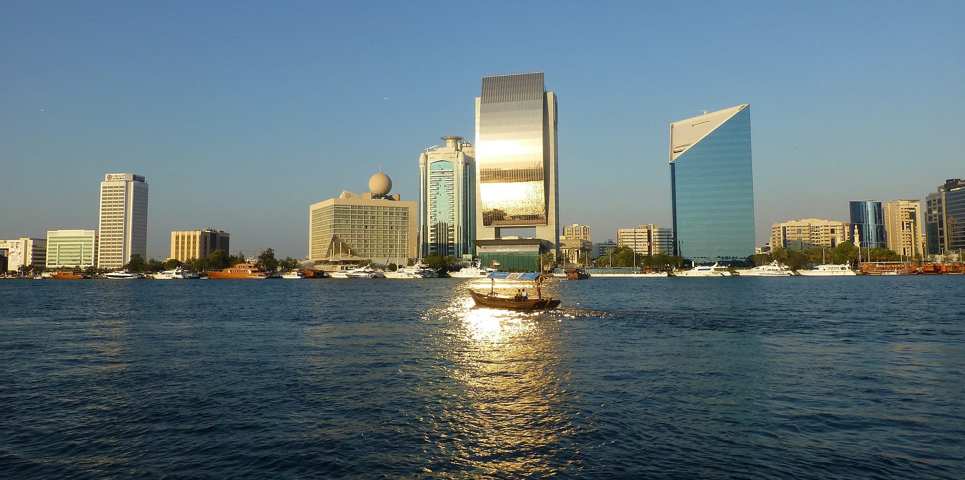
What a difference 62 years—and oil—makes on a place!
The Value Proposition
Why should you be reading this blog, or receiving it as a newsletter? This is why.
☕ If you appreciate what I do, buy me a virtual coffee from time-to-time to support my work. I know it seems small, but it truly helps.
📖 You could also buy my newest book.
🎓 Like learning? Find out what courses I’m currently offering at my website.
📽 More the visual type? Here is my YouTube channel with tons of free history videos.

Comments ()